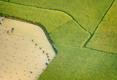
Researchers from the University of Bonn have harnessed cutting-edge technology and innovative methodologies to achieve an unparalleled understanding of global water distribution and its changes over the past two decades. By fusing the hydrological model WaterGAP with data from the GRACE satellite mission, the team, led by Prof. Dr.-Ing. Jürgen Kusche, has generated an intricate portrayal of Earth's water balance dynamics. Their groundbreaking findings, soon to be published in the Journal of Geodesy, illuminate the extent and impact of droughts and facilitate forecasts of climate change effects on water systems.
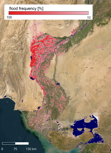
The refined technique not only enhances our comprehension of historical water distribution but also offers a means to forecast potential climate change repercussions, such as alterations in precipitation patterns and rising temperatures. By juxtaposing climate models with precise measurements, the researchers can predict the future water balance across different regions worldwide, thus contributing vital insights to climate change assessment. The study reveals that the prevalence of droughts across the globe is more significant than suggested by GRACE satellite data alone. The team's approach uncovers widespread drought occurrences, even in regions where the satellite information indicated otherwise. For instance, the extensive Amazon drought in 2010 affected a much larger expanse than initially observed from satellite data, underscoring the method's ability to capture localized droughts that might escape satellite detection. Collaborating with researchers from Goethe University Frankfurt and Warsaw, the University of Bonn's team seamlessly merged satellite data with high-resolution meteorological information for the first time. This integration substantially enhanced the resolution of water distribution maps, reducing the scale from approximately 300 kilometers to 50 kilometers. The integration leveraged the "WaterGAP" hydrological model, developed at Goethe University Frankfurt, and a mathematical technique akin to weather forecasting.
The team utilized data from the GRACE-FO satellite mission, launched in 2018 as a successor to GRACE, which had been active from 2002 to 2017. GRACE-FO's gravitational force measurements, based on variations in the Earth's gravitational field, offer insights into the water cycle's surface-level processes. The intricate relationship between gravity and water mass changes provides valuable information about groundwater, surface reservoirs, and glacier melting. One distinct advantage of GRACE measurements lies in their comprehensive coverage of various reservoirs, including hidden groundwater reserves deep within the Earth's crust and numerous artificial lakes and wetlands. While GRACE data offers unmatched insights into Earth's gravitational field, the measurements suffer from spatial inaccuracy, with a resolution of approximately 300 to 350 kilometers. To surmount this limitation, the University of Bonn researchers integrated GRACE data with high-resolution meteorological records and modeling techniques. This approach significantly advances our understanding of water distribution, serving as a valuable tool for deciphering the intricate interplay between water systems and climate changes.
A CSR Initiative of

Designed and Executed by

Implemented by


 Technology is a useful servant, but a dangerous master, it was rightly said. Electronic devices have grown into an inevitable part of our daily lives.