Archaeologists from the University of Exeter have harnessed laser scans from the Environment Agency's National LiDAR Programme to uncover a previously unknown Roman road network that spanned across Devon and Cornwall. This remarkable discovery challenges existing assumptions about the Roman road system and offers insights into the historical connections between significant settlements and military forts.
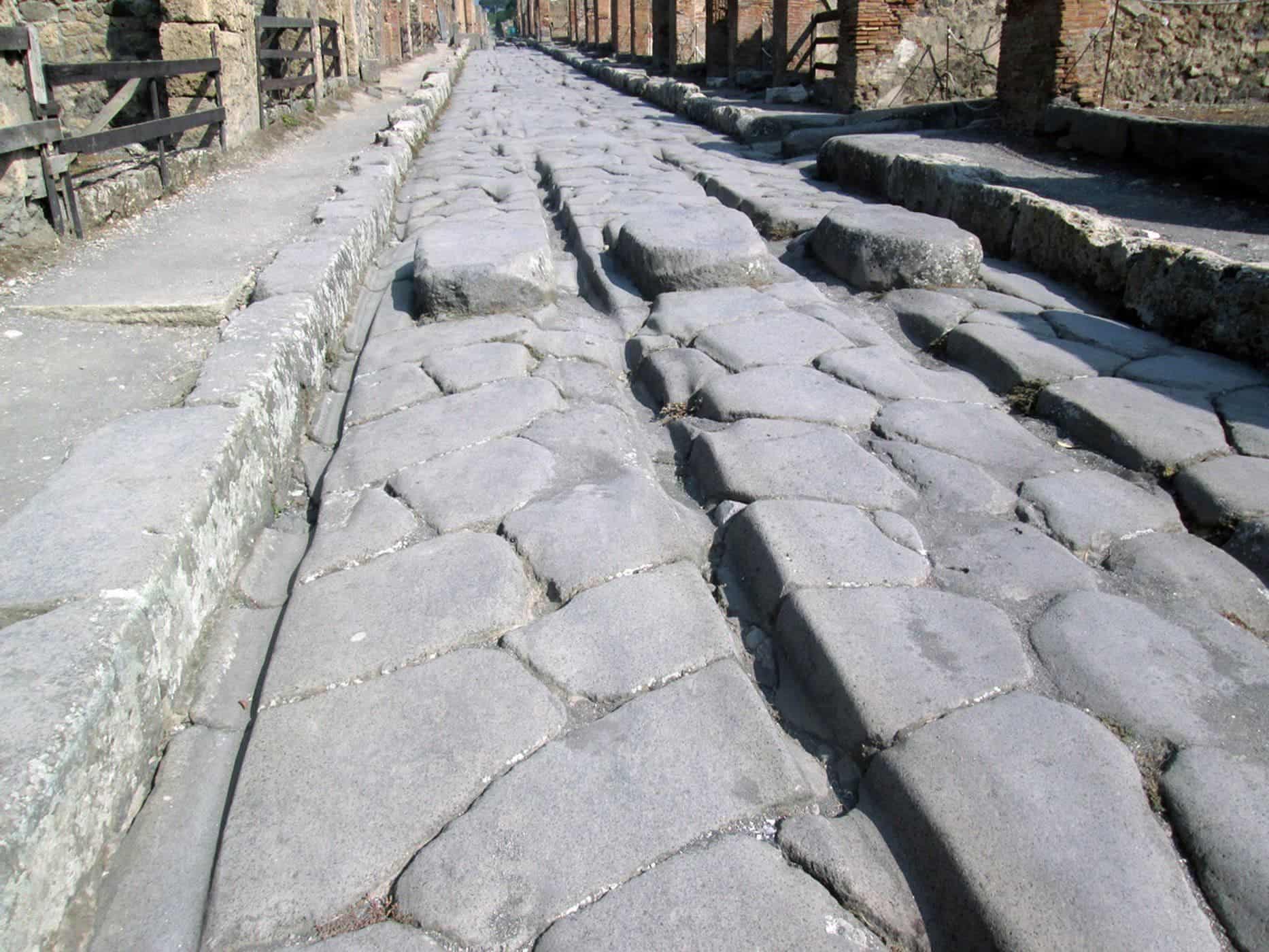
Employing sophisticated geographical modeling techniques and considering factors such as gradients and flood risks, the researchers expanded their understanding of the road network beyond previously established boundaries. Contrary to previous beliefs that Exeter was the network's hub, the study reveals that North Tawton played a more crucial role, connecting strategically vital links with tidal estuaries to the north and south of Bodmin and Dartmoor.
This research was detailed in the Journal of Computer Applications in Archaeology and was spearheaded by Dr. Christopher Smart and Dr. João Fonte, experts in Roman Empire heritage and landscape archaeology at Exeter's Department of Archaeology and History. Dr. César Parcero Oubiña, an authority on geospatial technologies applied to archaeology at the Spanish National Research Council, led the modeling of the Roman road network. The study's significance lies in its innovative approach. Laser scans from the National LiDAR Programme, which covered all of England between 2016 and 2022, provided a more comprehensive view of the terrain in Devon and Cornwall, greatly expanding the mapping capabilities. Working in collaboration with volunteers and funded by the National Lottery Heritage Fund, the Exeter team meticulously studied the scans and managed to identify around 100 km of additional roads.
To fill the gaps in the fragmented data, the researchers developed a predictive geographic information system model. This model, based on Least Cost Paths and other techniques, helped outline primary and secondary nodes, including military forts and settlements, and calculate the optimal routes connecting them. The team then cross-referenced the LiDAR scans to identify another 13 km of Roman road within proximity to the model's predictions. Further iterations of the model extended the road network to areas beyond the known Roman sites in the region, suggesting secondary or tertiary routes. The research concludes that the network aimed to facilitate animal-drawn vehicles and avoid flood-prone areas. The implications of this discovery are far-reaching. The newfound network could potentially lead to the identification of previously unknown settlements. Additionally, the research reiterates the complexity of Roman infrastructure investment and settlement hierarchies in the South West of Britain.
In essence, this pioneering research demonstrates how cutting-edge technology can transform historical understanding and reshape perceptions of the past. The Roman road network uncovered through LiDAR scans offers a unique glimpse into the intricate connections that once spanned the regions of Devon and Cornwall.
A CSR Initiative of

Designed and Executed by

Implemented by


 Technology is a useful servant, but a dangerous master, it was rightly said. Electronic devices have grown into an inevitable part of our daily lives.