Egypt has taken a significant step forward in its space program with the launch of Horus-2, a satellite aimed at monitoring climate change and addressing the growing water scarcity issues in the country. According to NASA's Earth Observatory, a mere 4 percent of Egypt's land is suitable for agriculture, and that number is steadily decreasing due to rapid urbanization accompanying population growth. To counter this trend and ensure food security, Egypt has been increasingly relying on satellite data for finding effective remedies.
For several decades, Egypt has been focused on climate change monitoring through its space program. The country has utilized satellites since the 1970s to measure changes in land surfaces and topography, with its satellites being tied into the National Authority for Remote Sensing and Space Sciences. Egypt's space aspirations have included the launch of telecommunications and remote sensing satellites, making it the first Arab country to achieve these milestones. While some satellites were lost in space, Egypt replaced them, and in 2018, the Egyptian Space Agency officially became the country's space authority.
The Horus series of satellites is of paramount importance to Egypt's climate change policy. Horus-2, in particular, is expected to meet the requirements of Egypt's sustainable development vision for 2030. By identifying crop and agricultural land use, the satellite's data will contribute to Egypt's efforts in enhancing its food self-sufficiency. Equipped with high-resolution, multi-spectral imaging cameras, the Horus satellites capture detailed pictures that enable scientists to gain a deeper understanding of the environment. Egypt's focus on climate change monitoring extends beyond its own agricultural capabilities to the broader African continent. During the COP27 climate change conference in November 2022, Egypt emphasized its space program as a technological advantage, particularly in relation to climate change. Recognizing the importance of international partnerships, Egypt has collaborated with China in developing the Horus series. China has significantly contributed to the program's funding, solidifying the joint commitment to address climate-related challenges.
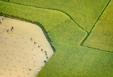
Egypt's satellites play a crucial role in monitoring changes in land use, both urban and rural. The country's optical satellite imagery is capable of capturing various land cover classes such as vegetation, bare soil, water, and impervious surfaces like roads and buildings. This analysis helps update Egypt's national land use and land cover map annually. The satellites also monitor the marine environment, recording oil pollution for an early warning system, and track land transformation from agricultural areas to urban settlements. By utilizing this satellite data, Egypt aims to set a standard for the country and its neighboring nations, encouraging the use of space science to meet climate change requirements.
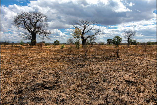
In addition to Horus-2, the Egyptian Space Agency has plans to launch two more satellites that will specialize in monitoring climate change and plasma fluctuations in the upper atmosphere above North Africa. Egypt also aims to play a significant role in the establishment of the African Space Agency, a long-discussed initiative. With its commitment to addressing climate challenges, Egypt's space program is not only beneficial for the country itself but also for the entire African continent. African nations, being highly vulnerable to climate change effects such as desertification, water shortages, erosion, and drought, can benefit greatly from Egypt's satellite data and expertise. The launch of Egypt's satellites to monitor climate change in Africa is a crucial step in tackling climate-related challenges and their associated phenomena. By monitoring and capturing changes as they occur, these satellites enable the development of effective plans to mitigate and address the impacts. This proactive approach helps minimize damage and negative effects. The emphasis placed on Egypt's space program during the COP27 conference showcased the country's technological edge in combating climate change, and it was well-received by participants.
Egypt's land-use analysis focuses on both urban and rural areas, with a particular emphasis on rural regions due to their topography and water resources, or lack thereof. This is especially significant in the southern part of the country, where intensive agricultural projects and aqua filters are being implemented to compensate for the loss of water resources caused by the Grand Ethiopian Renaissance Dam project. Egypt's satellite imagery provides valuable insights into land use, supporting decision-making processes related to resource management.
A CSR Initiative of

Designed and Executed by

Implemented by


 Technology is a useful servant, but a dangerous master, it was rightly said. Electronic devices have grown into an inevitable part of our daily lives.